A mid-week walk, arrival by car-sharing.
Contact: Brian
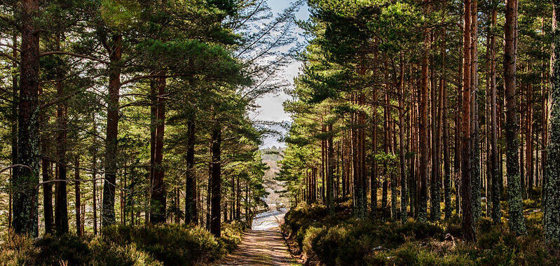
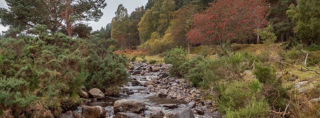
Image by Gary E
A midweek walk. Arrival by car-sharing. Contact: Ken
June’s midweek walk will be a rare move to the Wednesday. It will be on Midsummer Day, the 24th of June. We’ll be assaulting Morven from the road to Groddie near Logie Coldstone. (My recce of the previously intended approach from Tullich suggested it was too much for a midweek walk.)
Many people start this walk by parking at the fork a little short of Groddie, but I found rumours that the parking is unavailable due to timber extraction work to be true. The walk will start instead from the nearby gate at NJ 411 043, OS Landranger 37, (what3words ///hunt.ascendant.hawks) before heading west to the ruin of Balhennie. There is space for two cars to park on the verge by the gate and another four at the other side of the road. I estimate there could be space for another five cars 250m before that, on a large grassy splay at a field gate just after rounding the bend at Bridgefoot. We will be setting off at 10am. OS Maps says the route is a bit over 10km with 665m of ascent and takes under 4 hours. My recce with stops and sightseeing took 5.
Car sharing will be from the usual Kingswells Park and Ride location at 8.45. The drive from there is about an hour.
The route follows clear paths and tracks with a fairly constant slope from Balhennie round the side of the hill above the Coinlach burn to a flat area below Little Cairn. We then head up to the top of Morven via Little Cairn and Mid Cairn. The weather will of course be fine 😊 and we should be able to see from Buchan down to Fife and across to the Cairngorms. Lunch will likely be taken at summit cairn or adjacent trig point. At the same time, the little Braemar mountain rescue box may be examined and, if desired, a donation made by scanning the QR code.
The return will be the reverse of the above. (There is a direct path connecting Balhennie to Little Cairn which is used in a number of described routes to and from Morven but my recce showed it to be relentlessly steep and, with some sections of very loose pebbles, just asking for trouble.)
The only nearby public toilets appear to be at the Commercial Hotel in Tarland (part of the comfort partnership scheme.)
Please let me know if you intend coming via email alistair.birnie@btinternet.com or text 07833502526.

Thursday May 28th.
Maps: OS Landranger 45 (Stonehaven), or Explorer 396 (Stonehaven etc.).
Meet to car-share at Kingswells Park & Ride (lower section) at 9:15, or at Glensaugh Farm (AB30 1HB, grid ref. 670783) at 10:15. There is ample parking space at the Farm, where possibly a toilet will be made available to us; I will confirm to participants shortly beforehand.
From Kingswells, travel seems quickest, at 43 minutes, via the AWPR and the A90, Drumlithie (beyond Stonehaven, turn R off the A90), Auchenblae and Drumtochty Glen (turn west at top of hill in Auchenblae), but some may prefer the South Deeside Road, Strachan and over the B974 Cairn o’Mount road (turn sharp R at Clatterin’ Brig), at 48 mins from KW P&R.
The walking route uses the quiet public road for 200m, and then goes up the pleasant then impressive Slack-Birnie Den on grassy/bouldery surfaces to near its head, where we break out up right on heathery ground to ascend Goyle Hill (464m) with its trig point and an obvious lunch spot with tree shelter nearby if needed. From there, we descend via grass and/or forest tracks to the public road near the Glensaugh-Strathfinella col, the exact route depending on deer farming and forestry operations. Across the road, a path contours gently above Loch Saugh along the bottom of Strathfinella Hill back to the Farm.
The Clatterin’ Brig tearoom appears to be closed currently, but may re-open (but only until 3pm?) by the time of our visit: again, I will confirm shortly before 28 May. If not available, the nearest place is Castleton Farm Shop, just off the A90.
Contact Ken
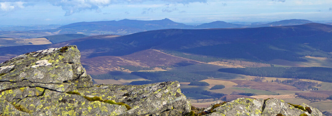
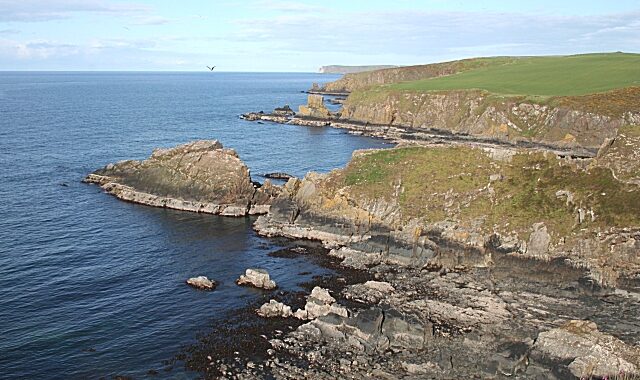
Photo by Scott Cormie
Thursday, 30th April.
Correen Hills, One way Traverse from Rhynie to Kildrummy
OS MAPS Landranger no 37 Strathdon & Alford or Explorer no 420 (OL62) Correen Hills (East Sheet). An A4 OS route map is attached to the email.
Car Sharing from Kingswells Park & Ride (west side of the lower car park). If you are coming from Aberdeen, meet here at 8.30 to be ready to set off for the Kildrummy layby in time for a 9.30 shuttle to Rhynie. (AA drive time 45 minutes)
Meeting time for all at Kildrummy layby (see below) : No later than 9:30 am. Some cars (the minimum needed) and all walkers will be driving to Rhynie (six miles) to start the walk. The remaining cars left at Kildrummy will be used to shuttle walkers back to Rhynie at the end of the walk.
Start time for walk from Rhynie, after car shuttle: 10:00 am
Kildrummy Meeting Point: the off-road layby on the west side of the A97 road (on the right-hand side if coming from Alford), one mile beyond the Mossat junction. It’s a fast road, so take care turning right into the layby. You can enter at either end of the looped layby. (Please all park facing towards Rhynie).
When we get back to Kildrummy, we will already have a plan for who can go straight home via Alford and who will go back to Rhynie and perhaps then home that way via Insch and A96. Leave driving shoes in your car, if left at Kildrummy.
Grid reference: GR NJ470 177
Nearest postcode: AB33 8QT
what3words: ///headliner.slurs.circulate
Parking for the start of the walk in Rhynie
We will drive 6 miles north to Rhynie along the A97 from Kildrummy (turning left at Mossat). At the Square in Rhynie, turn left onto the A941, and park in the Aberdeenshire Council car park on this road near the Church and School. If it is full, park where you can on the road.
Grid reference: GR NJ 497 272
Nearest postcode: AB54 4GH
what3words: ///mistress.grazes.petulant
Estimated finish time at Kildrummy: 3.30 pm, then some drive back to Rhynie to collect cars and home from that direction via Insch and A96, or back to Alford, as suits. Depending on numbers of cars and people, some cars may be able to go home via Alford, without returning to Rhynie. For those going back to Rhynie, you can return to Aberdeen via the Insch / A96 route (equidistant with the Alford route). It may be possible to make specific car shuttle arrangements for those living near Alford or Insch.
Walk Difficulty: A Moderate hill walking day
Distance: 17km / 11 miles – quite long, but we will take our time!
Ascent: 456m / 1,500ft
Overview A moderate hill walk, keeping at a steady pace, with a gradual climb of about three hours on tracks. The route heads south from Rhynie 180m, out of the Water of Bogie glen up onto the Correen Hills. We traverse over Badingair Hill 478m and Brux Hill 475m, and descend from
Edinbanchory Hill 466m, zigzagging down to the River Don valley at Invermossat. We cross over the Alford road, then walk up the Don for less than a mile before heading over the lower southern flanks of Ardhuncart Hill to the Kildrummy layby. Some, if not all, will need to return to Rhynie in the cars left at Kildrummy.
Booking
Booking is essential to sort out car-shuttling. Please contact the walk leader either by email jayturner1985@outlook.com or by texting Jay Turner on 07933 651 681 to book your place on the walk. Please say where you will be coming from and how many walkers likely to be in your car, and remember to contact Jay if you are no longer able to attend the walk.
Additional Details
Walking boots are strongly advised, plus waterproof jacket and overtrousers. Walking poles and gaiters are optional; the walk is all on paths and tracks Bring a packed lunch / hill food and a flask for hot / cold drinks. Make sure to bring plenty of water. There will be two or more likely three stops for coffee, lunch and a final rest.
There is one public toilet cubicle for women, plus facilities for men, in Rhynie (opposite the Corner Shop). There are also good public toilets en route in Alford, in the main public car park, if coming to Kildrummy that way.
The walk is not suitable for dogs.
A cuppa and cake after the walk
The Corner Shop in Rhynie does a good line in takeaway hot drinks and cakes (some made on the premises). There are benches all around the War Memorial on the Rhynie Green near the Church.
Contact Jay Turner or 07933 651 681
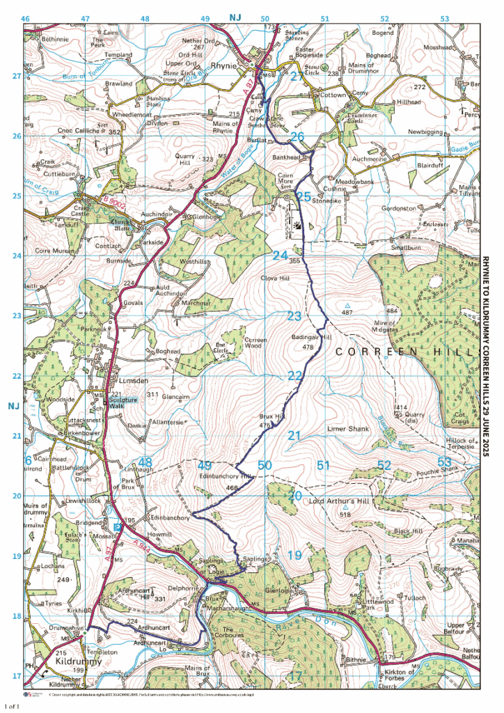
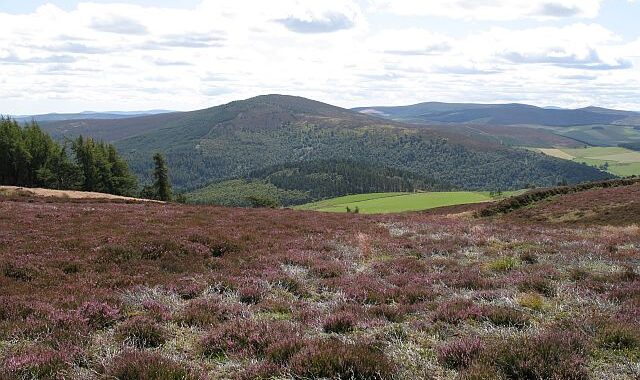
photo by Richard Webb
Midweek walk, contact meetorganiser5@cairngormclub.org.uk
An opportunity to explore the Pollagach Glen from Cambus o’May.
The glen is the subject of a 1927 Journal article “The Pollagach Rocking Stone” in which the author describes “a stretch of some three miles into which the Rocking Stone attracted me with all the alluring sense of discovery.” Further details can be found in Ken’s interesting historical note on the area (attached).
The route begins at the Cambus o’May car park (NO 423 975), crosses the bridge and briefly joins the B976 South Deeside Road. From here we begin an anti-clockwise loop following a track (sometimes muddy) which fords the Pollagach Burn before climbing uphill. The stone shelter towards the top of the track will make a good lunch spot, before we proceed to try our strength on the boulder marked as a Rocking Stone at NO 409 942. To avoid disappointment, I’ll say that previous attempts have been unsuccessful but maybe the combined strength of the Midweek Walkers will prevail. From the head of the glen, we will follow the track NE down to Greystone and then back to our starting point.
The route length is 10 km/6.5 miles with 320m of ascent. The burn crossing at the beginning of the walk is straightforward, as shown in the short clip below (when water levels were fairly high due to snow melt).
The meeting point will be the Cambus o’May car park at 10.30 am or Kingswells Park and Ride at 9.30 am for those who wish to car share.
This will be a new route for the club.
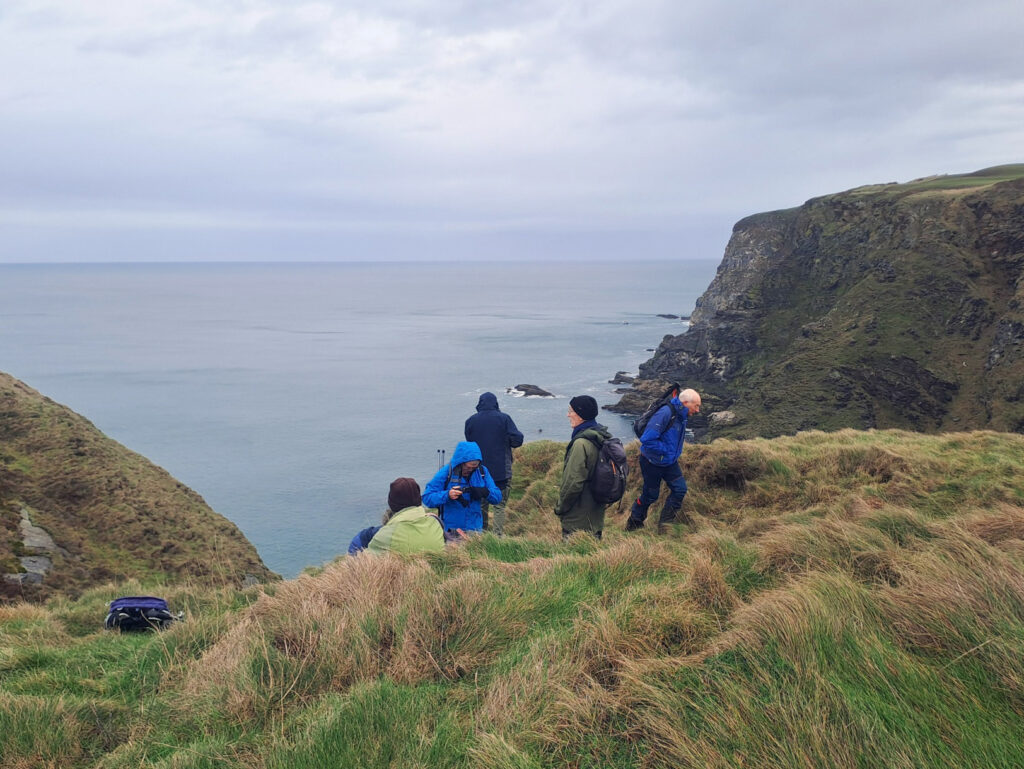
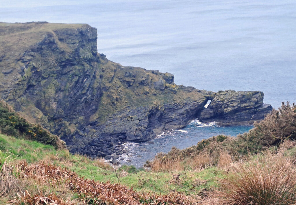
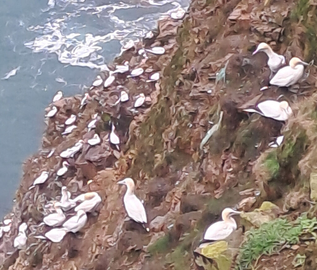
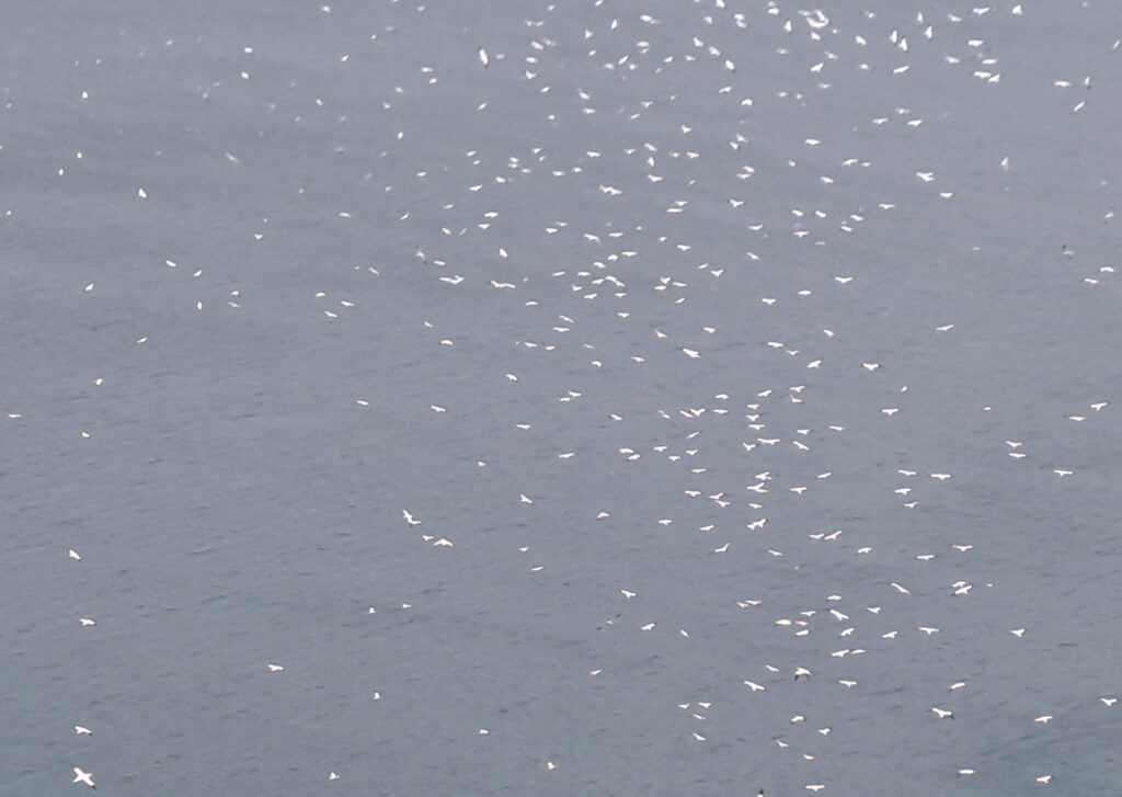
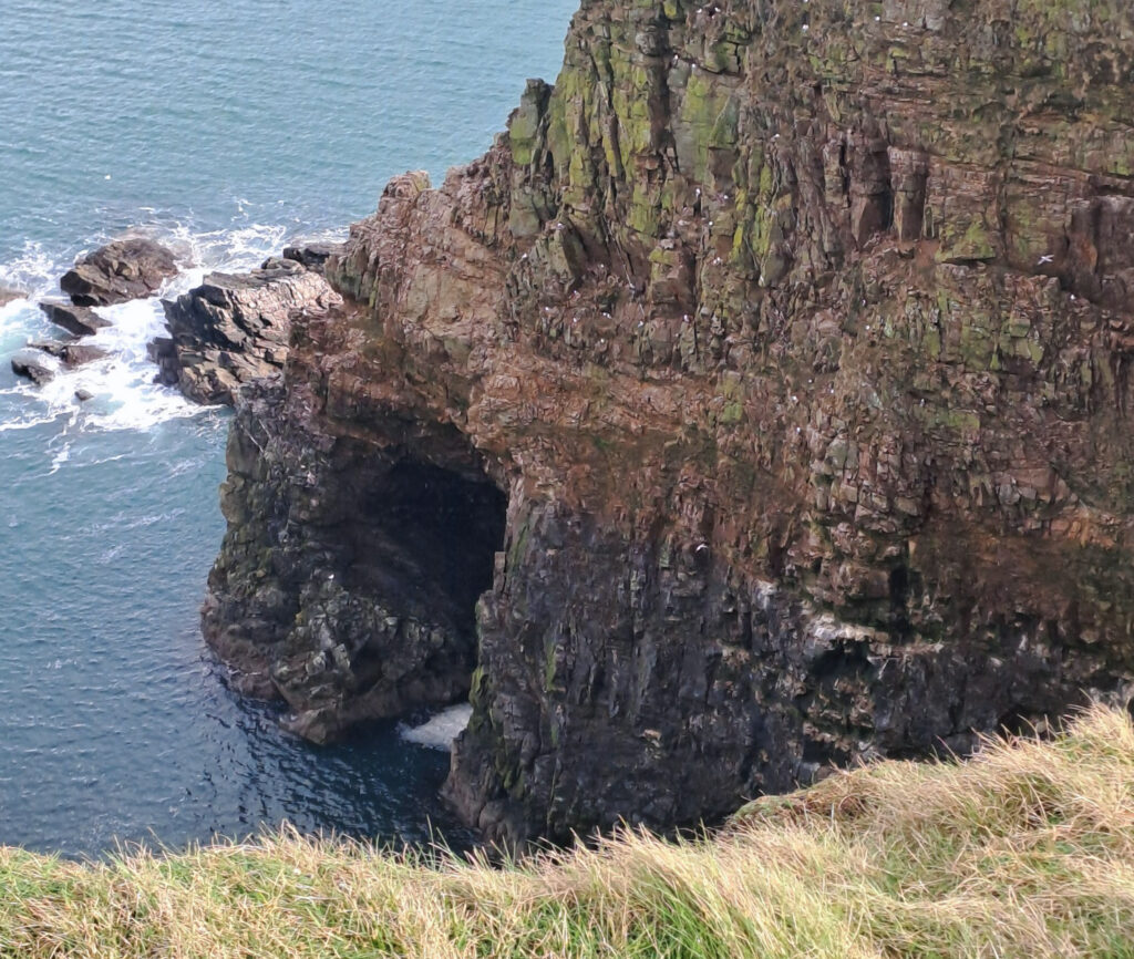
Troup Head is an RSPB reserve. It has the largest Gannet colony on Scotland’s Mainland. It was devastated with Avian flu ( losing 40% of adult gannets and 90% of chicks) but is making a good recovery. The birds are now returning from wintering at sea.
There are also Kittiwakes, Guillemots, Razorbills and other species. We also saw Hares.
You may also see Whales, Dolphins or Porpoises if you are lucky.
We will walk from Crovie (Crivie ) which is a little village sitting under the cliffs. Settlement since 1297. The Highland clearances in the 1900’s boosted the population to 300 mostly earning a living from fishing.. It was severely damaged in the 1953 storm and the council wanted to have it bulldozed but a campaign to preserve the village was successful and today it is protected by a conservation order.
We will do the 5 Farms and Troup Head circuit. Starting from Crovie viewpoint and carpark. This is the upper carpark on your left before going down the hill into village. Only local traffic recommended beyond this point. Grid ref NJ807652. It is a circular walk 9.5km / 6 miles.
Ascent 292 m. 3 to 4 hours depending on stops.
“A pleasant walk in good weather with a strong head wind at times. Interesting and high spot the Gannets coming ashore after wintering at sea. You don’t have to be a birdwatcher to enjoy the spectacle. “
A loop of around starting from the Tyrebagger car park (B979) Grid ref: 848 111
(Important – the meeting point is in the 2nd car park if turning left off the A96. Look for
the Green SPARROWS sign then turn left into the Forestry and Land Scotland car park)
There is plenty of space for parking and no charges.
Starting time: 10.30pm
Distance: around 6km
Time: 3 hours (depending on how many tea breaks/stops we have)
Route
From the car park take the waymarked RED route southwards through forest and then turn right at the sign to Elrick hill.
There is a gentle pull on a well-defined path to reach the top of Elrick Hill.
From there follow the path downhill to pick up a set of steep steps which will lead down to the car park for Elrick Hill.
Continue up the rough track to meet the road.
After crossing the road there is a (slightly overgrown) path which leads to a stile.
A feint path takes us uphill in a south direction and then E.S.E to meet the main track which heads to the summit of Brimmond Hill.
At the top we will hopefully have a panoramic view of the surrounding countryside from the sea to the mountains.
From here follow the main track back downhill to the Brimmond Hill car park.
Cross the road to pick up the path which runs through Craibstone Golf course, then head in a northwest-ish direction with the west woods on the right.
The path crosses a small burn then turns west. Follow this, passing the point where we turned off to head up to the summit of Elrick hill.
From here it a short walk back to the carpark.
Hazards to be aware of:
Possibility of cattle in field on the approach to Brimmond Hill. Any dogs must be kept on a
lead at this point.
To book, contact Joyce Ritchie
A midweek walk by car, with car-sharing possibilities for those without.
Depart at 10 am (car-share from Kingswells P&R at 9 am) from small parking area at the access road to Little Mill, immediately on left after crossing bridge over River Girnock on South Deeside road (B976) from Ballater, heading towards Crathie.
We set off on the main track, branching right through a gate and around the base of Creag Ghiubhais, and pick up another track around the base of Creag Nam Ban. Before reaching the drystone dyke, we start to traverse and gently ascend the slope of Creag Nam Ban. After the bealach, we cross the new fence line, and follow it up to the Duchess of Kent’s Cairn and onwards following the ridge line and other cairns to Sgor An h-Iolaire (544m). From the cairn we get great views down to Camlet and across to the Coyles of Muick, and (hopefully) great views of Lochnagar too. We then drop down to Camlet for lunch and pick up the Glen Girnock track back towards Loinveg, Little Mill, and the cars.
Distance : 12.5 km; total ascent 377m; terrain mostly good, but some sections off path. OS map Landranger 44 or Explorer 388.
After the Walk, we can return to Ballater and treat ourselves to coffee/tea and scones at the Rothesay Rooms, which will be open for last orders at 3.30pm.
A midweek walk. Travel by car, with car-sharing possibilities for those without.
Contact David Christie: 07731 333 033